
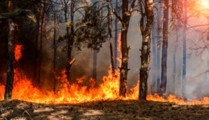
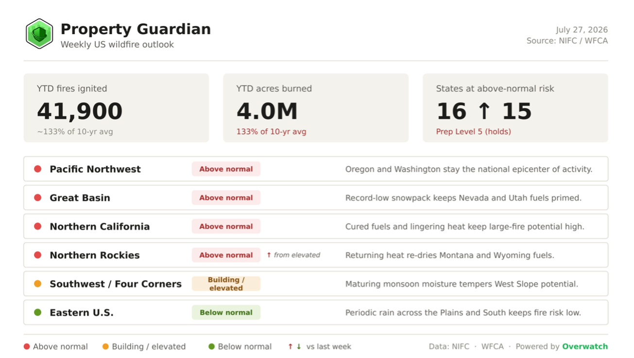
The U.S. enters this week deep in an elevated stretch of fire season: roughly 4.0 million acres have already burned year-to-date (about 133% of the 10-year average) across some 41,900 fires nationwide, and the week ahead points to broadening risk as heat rebuilds across the interior West.
Heading Into This Week
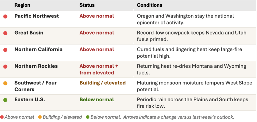
NIFC opens the week holding at Preparedness Level 5, the top of the national scale, where it has sat since mid-July. States at above-normal risk edge up from 15 to 16 as the Northern Rockies climb back to above normal, with returning heat across Montana and Wyoming re-drying fuels that a late-June wet spell had briefly eased. The Pacific Northwest, Great Basin, and Northern California all open the week firmly above normal.
Major Fires We’re Watching This Week
Large fires concentrated across the above-normal regions are driving the week’s risk picture, with the Pacific Northwest carrying the heaviest load:
- Big Grass Fire (OR) — 280,000 acres, 5% contained. Now the largest active fire in Oregon, burning rangeland in Malheur County after the mid-July lightning outbreak.
- Crosswhite Fire (OR) — 149,705 acres, 20% contained. One of the central-Oregon lightning fires pushing the state to 21 large incidents, the most in the nation.
- Kaiser Canyon Fire (WA) — 110,355 acres, 12% contained. Washington’s largest current fire, burning in Okanogan County near the Canadian border.
- Hay Creek Complex (OR) — 103,000+ acres, ~5% contained. A cluster of lightning-sparked fires across Gilliam and Sherman counties operating under Level 2 evacuations.
What’s Driving the Week Ahead
Conditions still trace back to a record-thin winter. Eight western states set record-low April 1 snowpack this year, and western snow water equivalent ran roughly 65% below normal, its lowest since 1981, with Oregon near 15% and California near 20% of normal. About 46% of the Lower 48 remains in drought, and more than 90% of the Intermountain West is now dry, leaving fuels cured and energy-release values running ahead of the calendar. Building this week is a fresh push of heat into Montana and Wyoming, running 6 to 12 degrees above normal and lifting Northern Rockies fire potential.
Further out, the Pacific has shifted to ENSO-neutral with an emerging El Nino favoring a near-to-above-normal Southwest monsoon, and monsoon moisture is already tempering the Four Corners. Meaningful relief, though, is not expected until late summer, leaving the weeks just ahead as the most exposed window.
Regional Risk Outlook
What This Means for Property Owners, Insurers, and Risk Managers
A maxed-out Preparedness Level and a newly above-normal Northern Rockies mean the week ahead, not August, is the time to verify exposure and harden assets. Property Guardian’s Overwatch platform tracks these shifts in near real time so teams can act on the exposed window before conditions peak.
Sources
National Interagency Fire Center (Statistics, National Fire News, Incident Management Situation Report, National Significant Wildland Fire Potential Outlook), Drought.gov, Climate Central, NOAA Climate Prediction Center, and the National Weather Service.
