
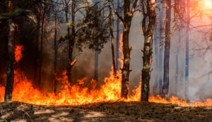
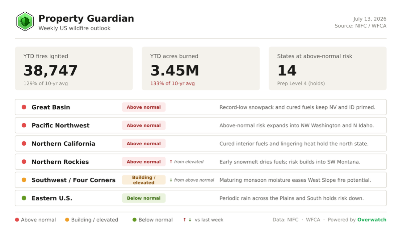
The U.S. enters this week deep in an elevated stretch of fire season — 38,747 fires have already burned about 3.45 million acres year-to-date (roughly 133% of the 10-year average), and the week ahead points to a risk picture that is shifting north rather than winding down.
Heading Into This Week
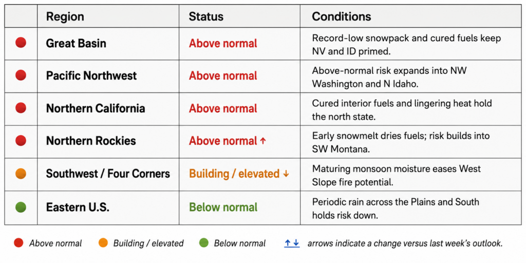
The national setup opens largely where it stood a week ago, but with a clear northward pivot. NIFC holds the National Preparedness Level at 4 — reached weeks ahead of schedule — and the count of states at above-normal risk holds at 14. The Northern Rockies enter the week newly above normal as early snowmelt and building heat spread large-fire potential into southwest Montana, while the Southwest / Four Corners eases from above normal to elevated as monsoon moisture matures over the West Slope.
Major Fires We’re Watching This Week
Several large fires are anchoring the week’s risk picture across the West and Intermountain region:
- Babylon Fire, Utah — 103,633 acres, 44% contained. The largest active fire in the West, burning 25 miles southwest of Monticello with multiple evacuation zones in place.
- Cottonwood Fire, Utah — 97,135 acres, 70% contained. Burning about five miles east of Beaver, where crews have made steady containment gains through the week.
- Aspen Acres Fire, Colorado — 97,083 acres, 28% contained. Now the seventh-largest wildfire in Colorado history, it has damaged or destroyed more than 850 structures and forced roughly 4,000 residents to evacuate.
- Ferris Fire, Colorado — 63,271 acres, 19% contained. Burning across the San Juan National Forest in Dolores and Montezuma Counties.
- Gold Mountain Fire, Colorado — 33,246 acres, 7% contained. Active on the Grand Mesa two miles north of Ouray, with limited containment so far.
Pocket Fire, Arizona — 27,451 acres, 74% contained. Burning seven miles north of Sedona in the Coconino National Forest, now largely lined.
What’s Driving the Week Ahead
Conditions still trace back to the same slow-moving drivers that have defined 2026. Snowpack across much of the northern West melted out weeks early and finished the season at record lows, leaving fuels cured and receptive far ahead of the normal calendar. Roughly 48% of the Lower 48 — and more than 75% of the West — remains in drought, and energy-release and fuel-dryness values are running well ahead of schedule for mid-July. Building into this week is a fresh round of hot, dry and breezy conditions across the western Great Basin, northeastern California, the northern Rockies and the Inland Northwest, with dry lightning from advancing monsoon moisture capable of sparking new starts.
Further out, an El Niño is developing and strengthening — NOAA now puts the odds of a very strong event this winter at better than 60% — and is favoring a near-to-above-normal Southwest monsoon that should keep nudging Arizona, New Mexico and the Four Corners wetter into late summer. That relief, however, is not expected to reach the northern West, where the weeks just ahead remain the most exposed window of the season.
Regional Risk Outlook
What This Means for Property Owners, Insurers, and Risk Managers
For property owners, insurers, and risk managers, a Preparedness Level pinned at 4 and a newly above-normal Northern Rockies mean the week ahead — not August — is the time to verify exposure, confirm defensible space, and harden assets in the highest-risk zones. Property Guardian’s Overwatch platform tracks active fire behavior, spread potential, and asset-level exposure in real time, turning this week’s shifting risk map into specific, address-level action.
Sources
National Interagency Fire Center (Statistics, National Fire News, Incident Management Situation Report, National Significant Wildland Fire Potential Outlook), Drought.gov, Climate Central, NOAA Climate Prediction Center, and the National Weather Service.
