
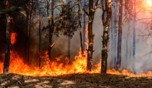
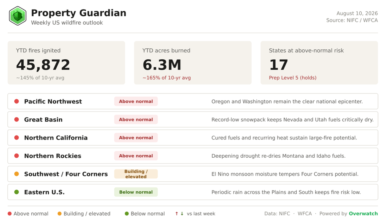
The US enters this week deep in one of its most active fire seasons on record: 6.3 million acres have already burned year-to-date, roughly 165% of the 10-year average, across nearly 45,900 fires nationwide, and the week ahead points to sustained above-normal risk across the Northwest.
Heading Into This Week
The National Preparedness Level opens the week at its maximum of 5, unchanged since mid-July, and the count of states at above-normal risk holds at 17.
The difference this week is scale: the national total now stands above 6.3 million acres, with Oregon opening the week past its all-time single-season record, and the Big Grass Fire on the Oregon-Idaho border entering the week as the nation’s largest active wildfire.
The picture heading into the week is one of steady, maximum-alert conditions rather than a fresh jump in risk levels.
Fire weather for the week ahead
The week opens with dangerous fire weather across the Northwest. The Storm Prediction Center places central and eastern Oregon under a critical fire-weather risk and central and eastern Washington, north-central Oregon, and the northern Lower Columbia Basin under extremely critical, reinforced by a rare Particularly Dangerous Situation (PDS) Red Flag Warning.
Winds gusting 35 to 55 mph against single-digit relative humidity, as low as 3 to 10% in eastern Oregon and Idaho, set the stage for rapid fire growth through the first half of the week, while isolated dry thunderstorms add new-ignition potential over the Great Basin and the Wyoming high country.
Relief is in the forecast but uneven: the Climate Prediction Center’s 6 to 10 day outlook favors above-normal precipitation across the Southwest, Great Basin, and Intermountain West, with the best odds over Arizona, Utah, and eastern Nevada as monsoon moisture surges north, even as a subtropical heat ridge rebuilds farther east into the following week.
Fire spotlight
This week’s marquee fire is the Big Grass Fire, burning cured rangeland along the Oregon-Idaho border in Malheur County, Oregon and Owyhee County, Idaho. Now the nation’s largest active wildfire at 472,060 acres and 41% containment, it has spread explosively through grass and sage fuels near Jordan Valley and across the state line, driving a state of emergency, a National Guard deployment, and mass evacuations on both sides of the border.
With a PDS Red Flag Warning in effect over the same footprint, the fire’s uncontained flanks face renewed wind-driven growth in the days ahead. For insurers and risk managers, a rangeland fire of this scale is a reminder that exposure in the Great Basin’s grass and sage country can shift in hours, not days, and that active-fire intelligence, not last season’s map, is what defines the current risk.
Major Fires We’re Watching This Week
Several large fires are driving this week’s risk picture across the above-normal regions:
- Big Grass Fire (OR/ID) — 472,060 acres, 41% contained. Now the nation’s largest active wildfire, it has triggered a state of emergency, National Guard deployment, and mass evacuations across Malheur County, Oregon and Owyhee County, Idaho.
- Rowe Creek Complex (OR) — 320,834 acres, 53% contained. The largest fire burning within Oregon, part of a season that has now pushed the state past its all-time record of nearly 2 million acres burned.
- Tartar Fire (ID) — 158,022 acres, 82% contained. Crews in Washington County have made major progress, with containment climbing steadily as the fire winds down.
- Little Giant Fire (WA) — 82,000+ acres, 1% contained. Fast-growing on the Okanogan-Wenatchee National Forest, it is threatening communities in Chelan County with containment barely established.
- Big Buffalo Fire (MT) — 3,598 acres, 0% contained. A new start near Wolf Point on August 6, an early signal that Northern Rockies fuels are primed as drought deepens across the region.
What’s driving the backdrop
Underlying it all is a landscape primed to burn. Record-low mountain snowpack melted out weeks early across the Great Basin and Northern Rockies, roughly 48% of the Lower 48 remains in drought, and a strengthening El Nino (Nino-3.4 above +2 degrees C) is favoring the wetter Southwest monsoon now tempering the Four Corners, leaving the Northwest and Great Basin as the exposed window through late summer.
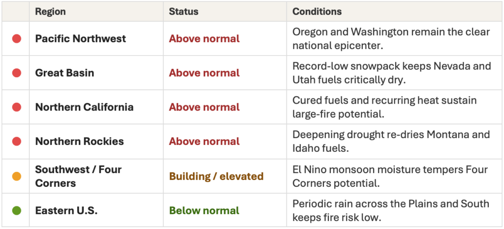
Regional Risk Outlook
What This Means for Property Owners, Insurers, and Risk Managers
For property owners, insurers, and risk managers, a maxed-out Preparedness Level and a still-climbing acreage total mean the week ahead is the time to verify exposure and harden assets, not after the next wind event.
Property Guardian’s Overwatch platform tracks these shifts in real time, so underwriting and risk teams can act on the window that is open now rather than reconstruct it later.
Sources
Statistics | National Interagency Fire Center
https://www.nifc.gov/fire-information/statistics
National Fire News | National Interagency Fire Center
https://www.nifc.gov/fire-information/nfn
SPC Day 1 Fire Weather Outlook
https://www.spc.noaa.gov/products/fire_wx/
SPC Day 2 Fire Weather Outlook
https://www.spc.noaa.gov/products/fire_wx/fwdy2.html
Red Flag Warning / PDS coverage (eastern OR, WA, ID) — KOIN
https://www.koin.com/news/oregon/red-flag-warning-eastern-oregon-washington-fire-danger/
CPC 6–10 Day Outlook
https://www.cpc.ncep.noaa.gov/products/predictions/610day/
CPC 8–14 Day Outlook
https://www.cpc.ncep.noaa.gov/products/predictions/814day/
Big Grass Fire — NW FireWatch
https://www.nwfirewatch.com/article/big-grass-fire-nations-largest-active-wildfire-burns-303000-acres-on-oregon-idaho-border
NICC Monthly/Seasonal Outlook (issued Aug 1, 2026)
https://www.nifc.gov/nicc-files/predictive/outlooks/monthly_seasonal_outlook.pdf
NIFC Statistics (YTD fires & acres)
https://www.nifc.gov/fire-information/statistics
