
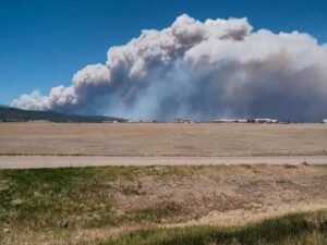
August 25, 2026 — A grass fire that ignited Monday afternoon in central Palo Pinto County has become the most active wildfire burning in Texas today.
The Ross Fire has raced to roughly 50,000 acres at just 5 percent containment, driven north into neighboring Jack County by steady southerly winds, triple-digit heat, and critically dry fuels. Mandatory evacuations are in effect, highways are closed, and the Texas A&M Forest Service has flagged the fire for large growth potential. For an event two hours west of the Dallas-Fort Worth metroplex, the speed of this run is the headline..
Timeline
The Ross Fire started as a grass fire Monday afternoon near Highway 180 and Ross Watson Road, west of the town of Palo Pinto. It escalated to multiple alarms almost immediately, moving from grass into brush and timber and pushing rapidly northward toward the Jack County line.
By early Tuesday, the situation had changed character entirely. Just before 3 a.m., emergency management issued a mandatory evacuation order for southern Jack County as the fire crossed the county line overnight.
By Tuesday morning the incident stood at 50,000 acres, still only 5 percent contained. That is a fire covering a substantial footprint in well under 24 hours, a pace that leaves very little margin for reactive decision-making on the ground.
Conditions Driving the Fire
The behavior here is a textbook product of the environment.
North Texas is facing another day of triple-digit heat and a high wildfire threat, with steady southerly winds, low humidity, dry vegetation, and no meaningful recent rainfall. Those ingredients combine to produce extreme fire behavior, and observers are reporting exactly that: long-range spotting and group torching along the fire front, with heavy smoke drifting from the eastern edge of Possum Kingdom Lake toward Mineral Wells and north toward Bridgeport Lake.
The mechanism matters for anyone modeling this risk. When winds are gusting and fuels are cured, a single spot fire launched ahead of the main front by ember cast can establish, grow, and merge before crews reposition. The Ross Fire is not the only incident in the region either.
The National Weather Service is monitoring several wildfires west of Interstate 35, which stretches firefighting resources thin at exactly the moment conditions demand the most from them.
Human and Community Impact
- Southern Jack County, near and east of Barton’s Chapel, is under a mandatory evacuation order. Residents are being routed east toward U.S. Highway 281, with an evacuation center established at the Twin Lakes Activity Center on Highway 59 in Jacksboro.
- In Palo Pinto County, residents north of Fortune Bend Road up to Highway 16 are under a voluntary evacuation. The city of Graford is on alert.
- U.S. Highway 180 is closed between South FM 4 and FM 919, and Farm-to-Market Road 4 has also been closed. A Temporary Flight Restriction is in place over the fire area.
- Livestock displacement is already a concern, with holding space being offered at the Old Mineral Wells Sale Barn for animals displaced by the fire.
Response is being coordinated by the Texas A&M Forest Service with Texas Intrastate Fire Mutual Aid System (TIFMAS) strike teams, dozers, and aircraft conducting aerial drops. Palo Pinto officials have requested additional resources from outside the county and from the state.
Historical Context
Texans do not need reminding of what fast wind-driven fire can do.
In February 2024, the Smokehouse Creek Fire in the Panhandle grew from roughly 40,000 acres to more than a million in about three days, becoming the largest wildfire in state history and the second largest in U.S. history. It ultimately burned about 1.06 million acres, destroyed hundreds of structures, killed more than 15,000 head of cattle, and claimed two lives. The prior benchmark, the 2006 East Amarillo Complex, burned more than 900,000 acres.
The Ross Fire is a different animal in scale, and it should not be equated with those record events. But the underlying dynamic is the same one that made Smokehouse Creek catastrophic: cured fuels plus sustained wind equals a fire that outruns containment.
What separates a 50,000-acre event from a million-acre event is often just how the weather breaks over the next 48 hours and how quickly resources can get ahead of the head of the fire.
What This Means for the Industry
For carriers, MGAs, and reinsurers with exposure across North Texas, the Ross Fire is a live illustration of why static risk assessment is not enough.
A property scored solely on historical hazard characteristics tells you what the baseline risk looked like yesterday. It does not tell you that a fire ignited near Highway 180 on Monday afternoon and that the parcel you underwrote sits in its projected path by Tuesday morning. The value of risk intelligence during an active event is measured in hours, not quarters.
This is precisely the gap Property Guardian Overwatch is built to close.
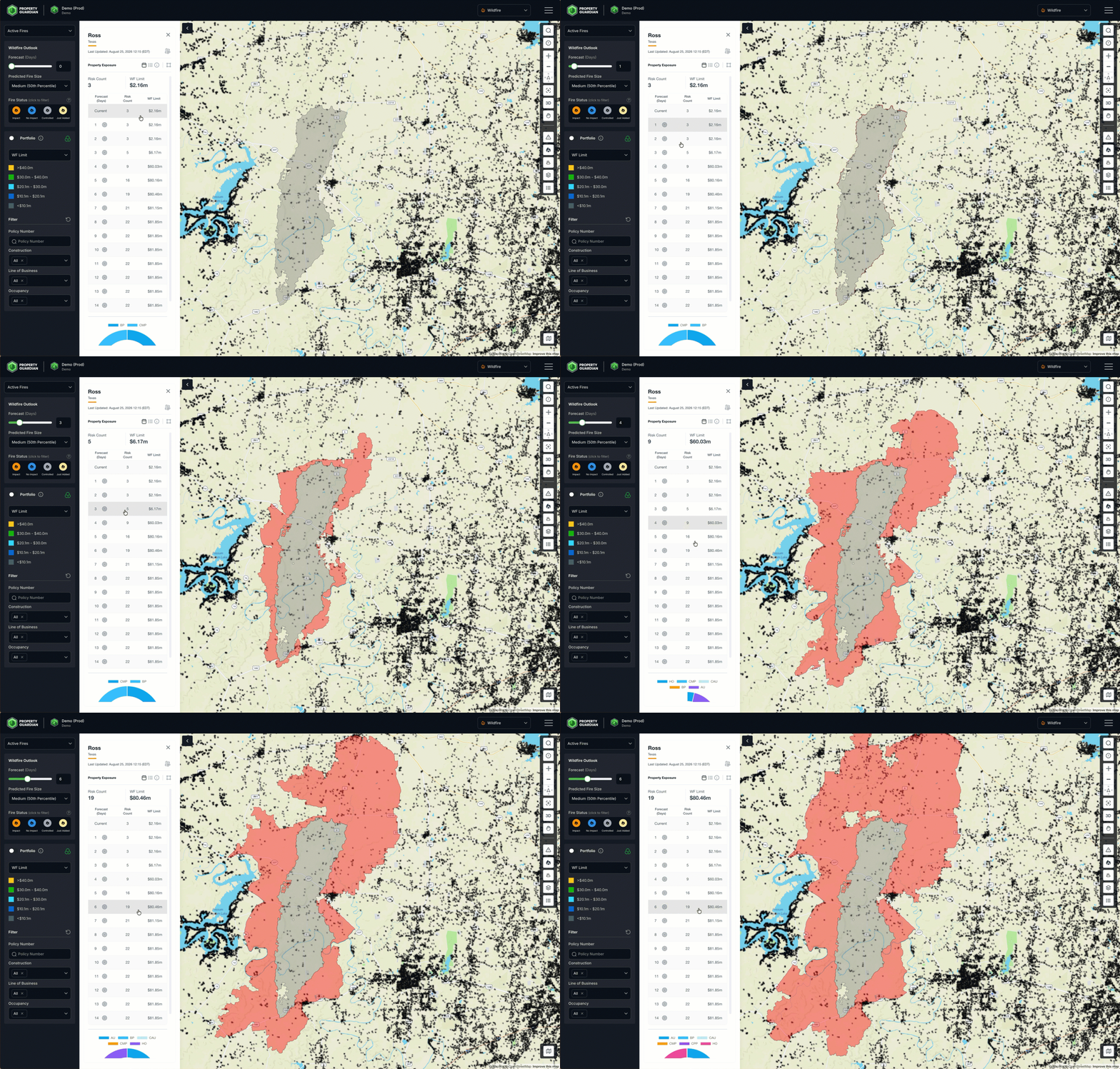
Overwatch fuses active fire detection, weather forecasting, topography, and fuel data into forward-looking wildfire spread intelligence, projecting where a fire is likely to move up to 14 days out.
For an underwriting or claims team watching the Ross Fire, that translates into a concrete operational picture: which insured locations sit inside the anticipated spread footprint, where to prioritize outreach and mitigation, and how exposure is evolving in near real time rather than after the loss reports arrive.
Forward Look
With southerly winds continuing to push the fire north and northeast, the near-term pressure remains on southern Jack County and the communities along the U.S. 281 and Highway 16 corridors, with Graford on the watch list.
Containment at 5 percent means the fire’s ultimate size will be dictated by whether winds ease and whether crews can secure the head before the next heating cycle. The counties surrounding Possum Kingdom Lake should expect continued heavy smoke and rapidly changing conditions.
This is the kind of event where anticipation, not reaction, is the difference between a managed exposure and a surprise loss. Forward-looking spread intelligence turns an unfolding emergency into a set of decisions a risk team can actually make in time to matter. That is the standard the industry should be holding itself to for every fire like this one.
Sources
Texas A&M Forest Service
FOX Weather, FOX 4 Dallas-Fort Worth, NBC 5 Dallas-Fort Worth, WFAA, CBS Texas
Texas Farm Bureau, FOX Weather, Governing, WFAA (Smokehouse Creek Fire historical reference, 2024)
National Weather Service
