
For most of the past century, drought was the story of forest decline in the American West. Trees died back in dry years, then regrew when the rains returned. That mental model just lost its footing. At the Ecological Society of America’s 111th annual meeting, which ran in Salt Lake City from July 26 to 31, researchers presented evidence that fire has become the single largest driver of forest biomass loss across the western United States, outpacing drought, insect damage, and timber harvest combined.
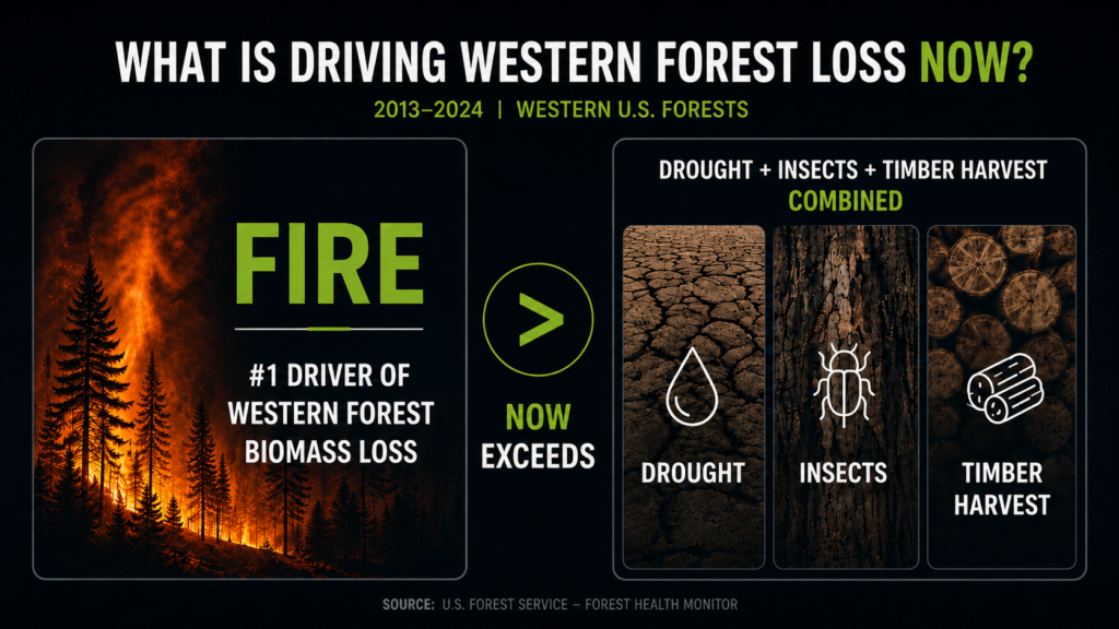
The analysis, presented by UCLA researchers Qian He and Park Williams, covered the period from 2013 to 2024 and spanned the full range of western forest types. Over that decade and more, fire did not merely rank among the top causes of aboveground biomass loss. It surpassed the other major drivers put together. A related 2026 paper in the Proceedings of the National Academy of Sciences from the same lab found that high-severity fire is now the dominant fire type in California forests specifically, not the low-intensity surface fire these ecosystems evolved with.
The Williams lab has also established that burned forest area in the West rises exponentially, not linearly, as the atmosphere grows warmer and drier. That matters because it links fire directly to the same aridity trend that drives drought. The two stressors are not independent. They compound. A hotter, drier year now delivers both the drought signal underwriters already price and a fire signal that is climbing on a steeper curve.
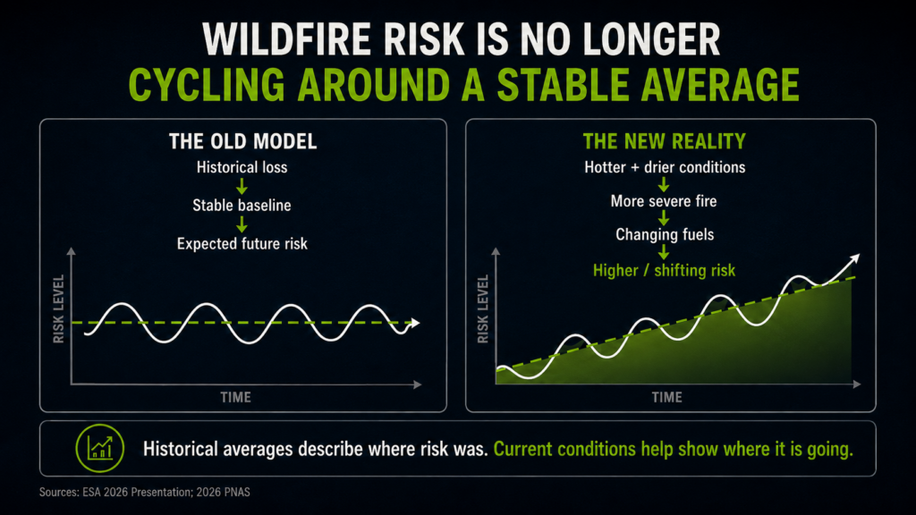
There is a second-order finding that deserves attention. Western forests have long been treated as carbon sinks and, implicitly, as resilient systems that bounce back. A forest thinned by drought can regrow. A forest restructured by repeated high-severity fire on a roughly ten-year cycle may not return to its prior state at all. It can reorganize into a persistently lower-biomass landscape. For anyone underwriting property in or near these forests, the takeaway is blunt: the fuel and fire environment around insured assets is not cycling around a stable average. It is trending.
The meeting surfaced a related operational wrinkle. One session, titled “From Ember to Exabyte,” framed wildfire monitoring as a data-science problem in which the volume of satellite, sensor, and model output now exceeds the capacity to turn it into decisions. More data is being generated about fire than the industry can currently act on. That gap between raw information and usable insight is precisely where underwriting and risk selection are won or lost.
Why should a commercial property underwriter or corporate risk manager care about an ecology conference? Because the historical loss record that sits underneath most rating and accumulation models was built on an older fire regime. If fire severity and frequency have stepped up structurally, as this research indicates, then models anchored to twenty or thirty years of history will tend to understate both how often large fires occur and how much they destroy when they do. The exposure is not only mispriced individual accounts. It is correlated loss across a book when a single event runs through a region that used to be considered moderate hazard.
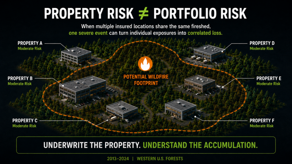
The research also points to a rebalancing of where the risk sits. High-severity fire is expanding its footprint across the interior West and into forest types that were not historically associated with catastrophic burns. Portfolios concentrated in what looked like the safer end of the wildland-urban interface may be carrying more accumulation exposure than last year’s map suggests.
Practical Takeaways for Commercial Property Teams
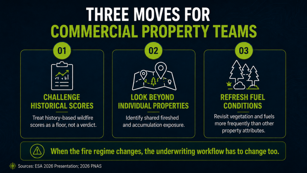
For commercial property underwriters and risk managers, a few moves follow directly from this research. First, treat any risk score built primarily on historical burn data as a floor, not a verdict, and ask whether it reflects the accelerating trend rather than the settled past. Second, look hard at accumulation. If several insured locations sit in the same fireshed, the relevant question is not whether each survives an average year but whether they share exposure to one severe event. Third, revisit the vegetation and fuel assumptions around key assets on a shorter cycle than you might for other perils, because the fuel environment itself is changing year over year.
For the operators of insured commercial properties, the same logic argues for treating fuel management and defensible space around the property as an ongoing operating discipline, documented and dated, rather than a one-time capital project. The condition that matters to a loss is this season’s condition, not the state of the grounds when the asset was acquired.
None of this means the West is uninsurable. It means the ground truth is moving, and the teams that keep their view of exposure current will price and select better than those relying on a static picture. That is the problem Property Guardian is built to solve. Our wildfire risk insight reports and portfolio-level exposure views translate current fire-environment data into property-specific and book-level signals, so underwriting and risk teams can see where the trend has already moved the risk, not where last decade’s map said it should be. When the baseline resets, the advantage goes to whoever sees it first.
Sources
Tech Times, “Fire Surpasses Drought as Top Driver of Western Forest Loss, ESA 2026 Finds,” July 31, 2026.
A. Park Williams lab, publications (ESA 2026 presentation; 2026 PNAS on high-severity fire in California forests).
PNAS, 2026, High-severity fire now dominant in California forests.
