
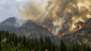
July 10, 2026 — The Aspen Acres Fire has burned nearly 100,000 acres across southern Colorado in less than two weeks, destroyed more than 279 homes and structures, and forced roughly 11,000 residents from their communities. As of July 9, it ranks among the seven or eight largest wildfires in Colorado history and among the state’s five most destructive by structures lost — a distinction that puts it in the same conversation as Cameron Peak, East Troublesome, and Marshall.
Event Snapshot
As of the morning of July 9, 2026, the fire had burned 96,121 acres with containment at 14 to 16 percent. It is burning roughly 10 miles northwest of Rye, Colorado, across Custer, Pueblo, Fremont, and Huerfano counties, within the Pike-San Isabel National Forest and along the Colorado Highway 165 corridor between Lake Isabel and Colorado City. The fire is human-caused, having ignited on June 29 near the Aspen Acres campground; the specific cause remains under investigation. Roughly 1,831 personnel, including the Alaska Complex Incident Management Team 1 and crews from dozens of states, are assigned to the response.
Timeline
The fire ignited June 29 amid red flag conditions and wind gusts reported near 100 mph, and grew explosively out of the gate — it had already reached roughly 23,000 acres within its first day. By July 2, it was one of several Colorado fires that had together scorched some 129,000 acres statewide under critical fire danger. By July 3, Aspen Acres alone had surpassed 74,000 acres and ranked eighth-largest in state history, with 11,000 people evacuated. It grew to 87,000 acres by the Fourth of July, past 91,000 by July 5, and to roughly 94,000 by July 7, when containment stood at 15 percent. By July 9, the fire had crossed 96,000 acres at 14 percent containment, with growth slowing as crews made progress on lines around Colorado City, Rye, and Siloam Road.
Conditions Driving the Fire
Southern Colorado entered fire season already primed to burn: record-low snowpack and severe-to-extreme drought have left live trees, brush, and shrubs critically dry. Layer in above-average heat, repeated red flag warnings, and erratic outflow winds thrown off by passing thunderstorms, and the result is a fire that has been difficult to predict and harder to hold. The ignition-day wind gusts near 100 mph are the clearest illustration of the mechanism at work: under those conditions, a single spark can outrun containment lines and grow by tens of thousands of acres within hours, long before resources can be repositioned.
Human and Community Impact
At peak, more than 3,800 addresses were under evacuation orders, affecting an estimated 11,000 people across Pueblo, Custer, Fremont, and Huerfano counties. Mandatory evacuations covered Beulah, Colorado City, Rye, San Isabel, Wetmore, Red Creek, Apache City, and surrounding areas. More than 279 homes and structures have been damaged or destroyed, making Aspen Acres one of the five most destructive wildfires in Colorado history by that measure. As containment has improved, some orders have begun to ease: Pueblo County anticipated lifting evacuations for its southern portion on July 10, and Fremont County has moved several zones from evacuation to pre-evacuation status.
Historical Context
Aspen Acres now sits alongside a run of Colorado wildfires that have redrawn the state’s risk map over the past six years. The Cameron Peak Fire (2020) remains the largest in state history at 208,913 acres, burning for 112 days and destroying nearly 500 structures. The East Troublesome Fire (2020), at 193,812 acres, is remembered for jumping the Continental Divide after exploding from roughly 20,000 to well over 100,000 acres in a 48-hour period of extreme fire behavior. The Marshall Fire (2021), though far smaller in acreage, remains the state’s most destructive wildfire by structures lost — more than 1,000 homes — a reminder that footprint and destructiveness don’t always move together. Aspen Acres’ combination of rapid early growth, near-100,000-acre footprint, and top-five structure loss places it firmly in that same tier of consequential Colorado fire events.
What This Means for the Industry
Aspen Acres is a case study in why static, once-a-year risk scoring can’t keep pace with how fires like this actually behave. A property that looked defensible on a spring underwriting model can sit in an evacuation zone by summer, not because the underlying terrain changed, but because drought, wind, and fuel conditions shifted underneath it. Fires that gain 20,000-plus acres in a single wind event compress the window for any manual review process to near zero. That’s the gap real-time monitoring is built to close: satellite and ground-based heat detection paired with live weather, topography, and fuel-moisture modeling can flag when a specific portfolio of properties moves from low to acute risk in hours, not weeks. Property Guardian’s Overwatch platform is built around exactly that continuous-monitoring approach, giving carriers and risk managers a current read on exposure rather than a stale one.
Forward Look
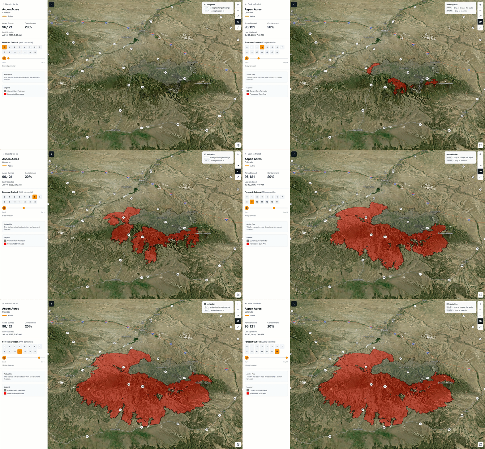
With containment still under 20 percent and drought conditions unresolved, the fire’s northwestern flank remains the area to watch, particularly where wind-driven runs could push it toward additional fuel-heavy terrain in Fremont County. Forecasters are watching for a chance of rain that could aid crews, but the same thunderstorm cells capable of bringing moisture have also been a source of the erratic outflow winds that have complicated suppression all week — a reminder that relief and risk can arrive in the same weather system. Continuous, forward-looking monitoring of exactly that kind of shifting risk is what Overwatch is designed to provide as this fire moves toward full containment.
Sources
Colorado Sun (coloradosun.com); Colorado Public Radio (cpr.org); FOX21 News Colorado (fox21news.com); KKTV (kktv.com); Denver7 (denver7.com); 9NEWS (9news.com); InciWeb Aspen Acres Fire Information (inciweb.wildfire.gov); Wikipedia, “Aspen Acres Fire” and “List of Colorado wildfires.
