
Property Guardian Overwatch
Property Guardian Overwatch delivers proactive, location-specific hazard insights — from wildfire impact forecasts up to two weeks out to multi-day hurricane tracking. Empower your team to anticipate threats, deploy mitigation resources effectively, and safeguard your portfolio with precision.
From Threat to Action. Zero Guesswork.
Whether you’re managing a portfolio of properties or coordinating vendor response, Property Guardian Overwatch gives you the clarity to act decisively. With forward-looking wildfire spread forecasts, multi-day hurricane tracking, and property-level threat insights, your team can streamline mitigation efforts, communicate with confidence, and stay ahead of escalating conditions.

Proactive Risk Awareness
Gain early visibility into wildfire impacts up to 14 days in advance and multi-day hurricane forecasts, with actionable insights that enable informed decisions to protect your portfolio.

Strategic Deployment
Precisely pinpoint the properties most at risk, enabling you to allocate mitigation efforts and deploy resources exactly where they’re needed most — when every second counts.

Streamlined Coordination
Quickly prioritize wildfire response with targeted insights, streamlining decisions and communication across teams, vendors, and policyholders.
Critical Intel.
Anywhere You Go.
Wildfires and hurricanes don’t wait for business hours. Now, neither do you. We’re excited to announce the launch of the Property Guardian Overwatch Mobile App for iOS and Android, giving you on-the-go access to real-time wildfire activity, risk forecasts, multi-day hurricane forecasting and property exposure insights using your existing login.
Own the Timeline. Control the Risk.
Stay informed. Stay ahead. From forecast to follow-through, Overwatch supports every stage of wildfire and hurricane risk.
Monitor Emerging Conditions
Track fire weather, hotspot activity, and regional risk trends before any direct threat emerges:
- Fire Weather Monitoring: Stay ahead of shifting conditions like wind, humidity, temperature, and lightning strikes with access to Red Flag and Critical Fire Weather warnings.
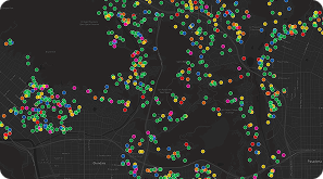
- Regional Fire Activity Watch: Monitor wildfire ignitions and behavior within your areas of interest — even if your properties aren’t yet directly threatened.
- Hotspot Detection: Identify areas with recurring wildfire activity or elevated threat potential to focus monitoring and planning efforts.
Anticipate the Threat
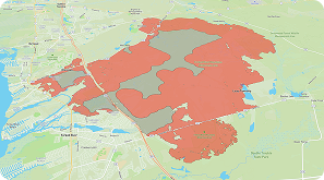
Use 1–14 day spread forecasts and property-level scoring to assess what’s at risk before impact:
- Wildfire Spread Forecasts (1-14 Days): Understand where the fire is heading, not just where it is. Access property-specific impact probabilities based on dynamic spread modeling.
- Property-Level Risk Insights: Zoom in on structure and parcel vulnerabilities, defensible space, terrain, and proximity to fuels to pinpoint high-risk locations in your portfolio.
- Portfolio Exposure View: Instantly quantify the number and value of properties forecasted to be in harm’s way — and prioritize accordingly.
Track the Storm
Stay ahead of the storm with authoritative forecasts and clear impact insights to protect people, property and portfolios:
- Live NHC Advisories & Wind Forecasts: Access the latest official storm tracks, intensity outlooks, and wind speed probabilities to inform decisions as advisories update.
- Custom Impact Alerts: Deliver hurricane-specific notifications to the right teams and policyholders instantly — from storm watches to projected wind impacts.
- Best-in-Class Visuals: Track evolving storm paths, cones of uncertainty, and exposure zones on an interactive map for fast, confident decision-making.
Coordinate Response
Prioritize field actions, engage vendors, and communicate with confidence as conditions evolve:
- Daily Threat Alerts: Receive automated updates when new properties move into the fire’s projected path — no need to refresh dashboards or dig for updates.
- Triage + Deployment Support: Overwatch helps prioritize which locations need boots on the ground, when, and with what guidance.
- Internal + External Coordination: Empower field teams, vendors, underwriters, and policyholders with clear, timely information to support mitigation and communication efforts.
Powerful Intelligence at Your Fingertips
Overwatch combines cutting-edge data, intuitive tools, and smart automation to help you manage wildfire and hurricane risk with speed and precision.

Alerts Your Way
Trigger alerts based on your risk profile — fire size, proximity, exposure value, and more. Get the right alerts to the right people, instantly.

Mobile App
Never miss a beat with instant access to insights around future wildfire and hurricane impacts from the convenience of your phone.
Portfolio Uploads
Easily upload and manage property lists to monitor specific assets — from a single structure to an entire book of business.
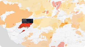
Spread Forecasts
View 1–14 day wildfire spread projections that model how fire could impact specific locations in your portfolio.
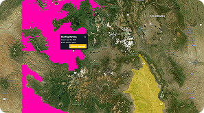
Red Flag Warnings
Monitor official fire weather warnings to anticipate periods of elevated wildfire ignition and spread potential.
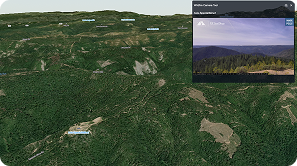
Live Cameras
Access integrated fire camera feeds for real-time visual situational awareness near active wildfires.
Hotspot Detection
Track newly detected thermal hotspots to identify wildfire ignition points as they emerge.
Wildfire History
Explore past wildfire footprints and recurrence patterns to understand long-term risk and vulnerability.
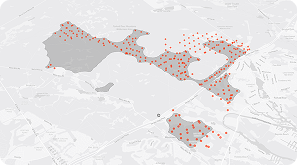
Structures Data
Assess exposure at scale using Microsoft’s building footprints to understand potential impacts across communities and industries.
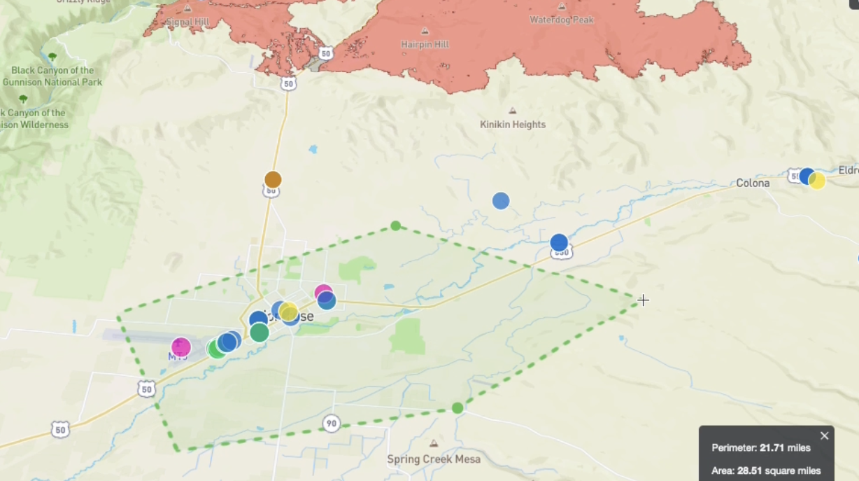
Flexible Selection
Filter portfolio segments with radius, lasso, or polygon tools and export to Excel in seconds — no GIS team required.
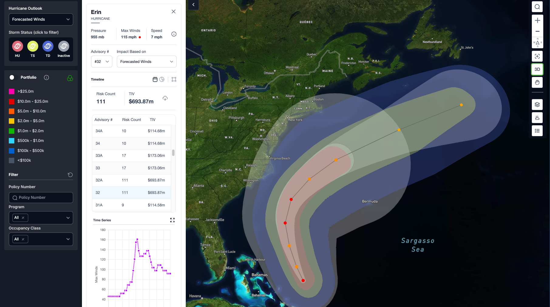
Hurricane Forecasts
Stay ahead with live National Hurricane Center advisories, storm tracks, and wind probabilities to understand exposure before landfall.
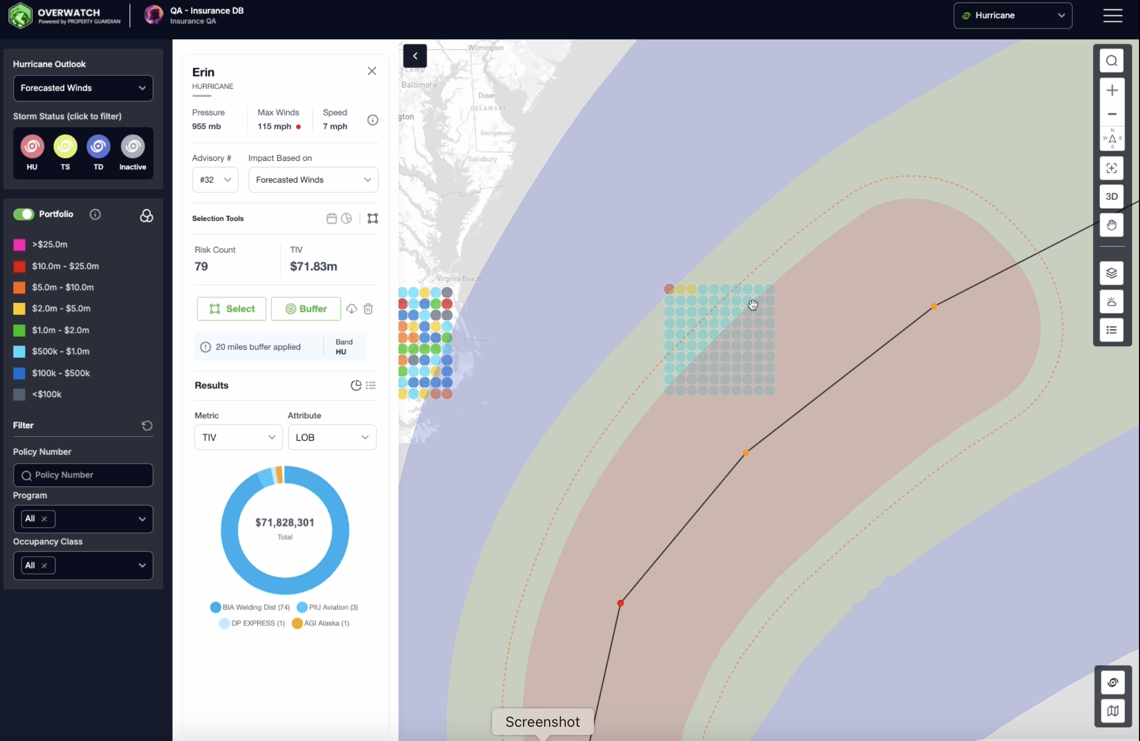
Buffer Analysis
Apply buffers to either a specific wind band or the broader forecast error cone – extending up to 50 miles – to get a clearer view of potential exposure.
Exact Impact Data that Every Stakeholder Needs
Property Guardian Overwatch is built for the professionals making high-stakes decisions under pressure. From predictive 1-to-14-day wildfire spread forecasts to detailed threat visibility and dynamic weather insights, Overwatch gives you the intelligence you need to stay ahead of the flames — and act with confidence..
Real-Time Wild Fire & Hurricane Intelligence — Start a Free Trial
Now’s your chance to see the difference Property Guardian Overwatch can make. We’re offering a free trial — contact us to get started!